Colorado Scenic Byways in 5 Days
Trail Ridge Road, Independence Pass and the Million Dollar Highway, Denver to Durango.
- Distance
- About 680 mi
- ≈ 1,090 km, rounded
- Time
- 5 days
- at a comfortable pace
- Best season
- Mid-Jun–early Oct
- Start → finish
- Denver → Durango
Colorado has more 12,000-foot paved passes than anywhere in the country, and the best of them string together into a five-day line across the Rockies: Trail Ridge Road above the tree line in Rocky Mountain National Park, the aspen valleys around Aspen, the sheer walls of the Black Canyon of the Gunnison, and the cliff-hugging Million Dollar Highway between Ouray and Silverton. It ends among the cliff dwellings of Mesa Verde.
Day by day
- 1
Day 1 · Denver to Estes Park
Out of the city by mid-morning, up the Big Thompson Canyon to Estes Park. Afternoon at Bear Lake and the short walk to Dream Lake, if your timed-entry permit covers the Bear Lake Road corridor. Elk graze in Moraine Park at dusk. See our Rocky Mountain guide.
about 70 mi · 1 h 30Sleep: Estes Park
- 2
Day 2 · Trail Ridge Road to Glenwood Springs
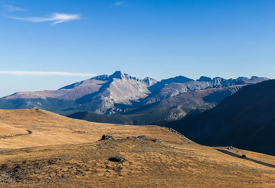
Trail Ridge Road climbs to over 12,000 feet, the highest continuous paved road in the country: stop at Many Parks Curve, Forest Canyon Overlook and the Alpine Visitor Center. Down to Grand Lake, then south and west along the Colorado River to soak in Glenwood Springs’ hot pools.
about 200 mi · 4 h 30Sleep: Glenwood Springs
- 3
Day 3 · Maroon Bells & the Black Canyon
Early to Aspen for the Maroon Bells reflected in Maroon Lake (shuttle or reserved parking). Then over McClure Pass through ranch country to the South Rim of the Black Canyon of the Gunnison: Gunnison Point, Chasm View and Painted Wall at sunset.
about 190 mi · 4 hSleep: Montrose
- 4
Day 4 · Ouray and the Million Dollar Highway
Ouray sits in a box canyon the locals call the Switzerland of America. US-550 south climbs Red Mountain Pass with steep drops and few guardrails, then descends to the mining town of Silverton and on to Durango.
about 110 mi · 3 hSleep: Durango
- 5
Day 5 · Mesa Verde
Ancestral Puebloan cliff dwellings, built in alcoves some 800 years ago: the Mesa Top Loop is self-guided, Cliff Palace and Balcony House are ranger-led and ticketed. Back to Durango for the evening.
about 110 mi round tripSleep: Durango
Short on days? Part of this route also works as a short trip, planned hour by hour:
Best month to drive Colorado’s byways
September is the month: the summer crowds thin, afternoon thunderstorms ease, and aspens turn gold from around the middle of the month in the high valleys. July and August are the warmest, with wildflowers on the tundra, but bring a rain jacket for daily storms above the tree line. Trail Ridge Road and Independence Pass usually close from mid-to-late October until late May — check the park and state road status before you plan a shoulder-season trip.
What to book ahead
- Rocky Mountain timed entry (late May to mid-October, 9 am–2 pm), with the “Timed Entry+ Bear Lake Road” option if you want Bear Lake. Released on recreation.gov.
- Maroon Bells: in summer and fall the road is reserved for the shuttle from Aspen Highlands or for pre-booked parking.
- Mesa Verde ranger-guided tours of Cliff Palace or Balcony House, on recreation.gov.
- Hotels in Estes Park and Ouray: small towns, few rooms, busy on summer weekends.
- A one-way car rental Denver–Durango, or a return flight from Durango.
Shorter or longer
Rocky Mountain and Trail Ridge only
3 days
A loop Denver – Estes Park – Grand Lake – back to Denver over Berthoud Pass. All the alpine scenery, none of the long drives.
Loop back via the Sand Dunes
7 days
From Durango, east over Wolf Creek Pass to Great Sand Dunes National Park, then north to Denver. Adds about 330 miles and two nights.
Continue into Utah
8–9 days
Mesa Verde is about two hours from Moab: link this trip with Utah’s Mighty 5 in reverse and fly home from Las Vegas.
Where to sleep along the way
Book the nights that matter first — inside or next to the parks, and in towns hosting a festival — then fill in the rest. Free cancellation keeps the plan flexible.
- Estes ParkHotels ↗
- Glenwood SpringsHotels ↗
- Montrose (Black Canyon)Hotels ↗
- OurayHotels ↗
- DurangoHotels ↗
Partner links · Trip.com
Our hand-picked hotels on this route
Road trip questions
What is the most scenic drive in Colorado?
Trail Ridge Road in Rocky Mountain National Park for the alpine tundra, and the Million Dollar Highway (US-550, Ouray to Silverton) for the drama. This itinerary drives both.
Is the Million Dollar Highway dangerous?
It is narrow, steep and has sections without guardrails, but it is a paved US highway driven daily. Go in daylight and dry weather, use low gears downhill and let faster locals pass at the pull-outs.
When does Trail Ridge Road open?
Usually from late May to mid-October, depending on snow. The park posts the current status on nps.gov/romo.
Do you need a 4x4 for this trip?
No. Every road in this itinerary is paved. The jeep roads around Ouray and Silverton (the Alpine Loop) do need a high-clearance 4x4 or a guided tour.
Written by Kylian Dev. Distances and drive times are without stops or traffic; add 25% for a realistic day.