New England in the Fall
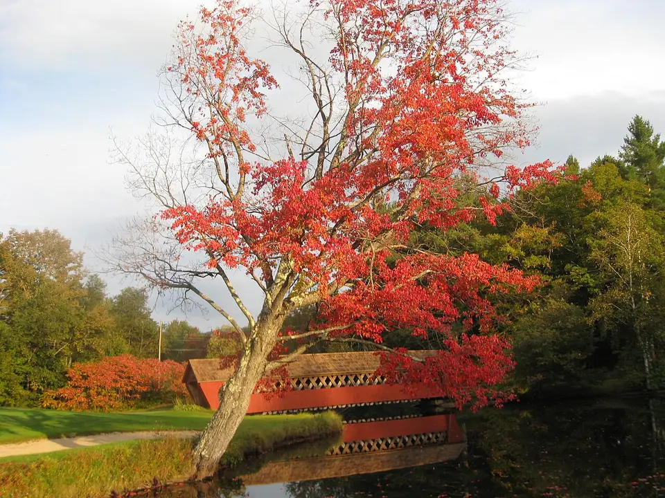
Red maples, covered bridges, white churches and lobster on the coast of Maine.
- Distance
- About 900 mi
- ≈ 1,450 km, rounded
- Time
- 8–10 days
- at a comfortable pace
- Best season
- Late Sep–mid Oct
- Start → finish
- Boston → Boston
For a few weeks every fall, the hardwood forests of northern New England turn scarlet, orange and gold. This loop from Boston takes in the rocky coast of Maine, Acadia National Park, the White Mountains of New Hampshire and the villages of Vermont — the America of maple syrup, apple cider and covered bridges.
Day by day
- 1
Day 1 · Boston to Portland, Maine
Pick up the car, Salem on the way, then Portland’s Old Port and the Portland Head Light.
110 mi · 2 hSleep: Portland
- 2
Day 2 · The Maine coast
Route 1 through Camden’s harbor and Belfast to Mount Desert Island.
175 mi · 3 h 30Sleep: Bar Harbor
- Days 3–4
Days 3–4 · Acadia National Park
Cadillac Mountain at sunrise (reservation), the Loop Road, Jordan Pond, the carriage roads in yellow birch. See Acadia.
Sleep: Bar Harbor
- 5
Day 5 · Into the White Mountains
A long drive west across Maine to North Conway, New Hampshire.
230 mi · 4 h 30Sleep: North Conway
- 6
Day 6 · Kancamagus Highway
Route 112, 34 miles of uninterrupted forest, with Sabbaday Falls and the Lower Falls; then Franconia Notch and its Flume Gorge.
100 miSleep: Lincoln or Franconia
- 7
Day 7 · Vermont: Stowe
Across the Connecticut River to Stowe, its white steeple and Smugglers’ Notch.
110 mi · 2 h 30Sleep: Stowe
- 8
Day 8 · Lake Champlain & Burlington
Ben & Jerry’s factory in Waterbury, cider donuts, the lakefront in Burlington.
40 miSleep: Burlington
- 9
Day 9 · Back to Boston
South via Woodstock, Vermont’s postcard village, and Quechee Gorge.
215 mi · 4 hSleep: [Boston](/cities/boston/)
Short on days? Part of this route also works as a short trip, planned hour by hour:
When do the leaves peak?
| Area | Typical peak |
|---|---|
| Northern Vermont & New Hampshire mountains | Late September – early October |
| White Mountains valleys, central Vermont | First half of October |
| Inland Maine, Acadia | Early to mid-October |
| Southern New England, Boston area | Mid to late October |
Where to sleep along the way
Book the nights that matter first — inside or next to the parks, and in towns hosting a festival — then fill in the rest. Free cancellation keeps the plan flexible.
Partner links · Trip.com
Our hand-picked hotels on this route
Road trip questions
When is peak fall foliage in New England?
Generally late September to mid-October in the north, mid to late October near the coast and in southern New England.
What is the best fall foliage drive in New England?
The Kancamagus Highway in New Hampshire is the most famous; Vermont’s Route 100 and Maine’s coast are close seconds.
How far ahead should you book a fall foliage trip?
Three to six months for weekends and popular towns like Stowe, North Conway and Bar Harbor.
Written by Kylian Dev. Distances and drive times are without stops or traffic; add 25% for a realistic day.