California Highway 1 in 5 Days
San Francisco to Los Angeles along the coast: Monterey, Big Sur, Hearst Castle, Santa Barbara, Malibu.
- Distance
- About 470 mi
- ≈ 760 km, rounded
- Time
- 5 days
- at a comfortable pace
- Best season
- Apr–May · Sep–Oct
- Start → finish
- San Francisco → Los Angeles
The coast road between San Francisco and Los Angeles is the one most people mean when they say “Pacific Coast Highway”. Five days is the right length for it: enough to give Big Sur a full day instead of a rushed afternoon, and to stop where the road invites you — a cypress headland, a cove of elephant seals, a mission town with red-tiled roofs. This is the compact version of our 7-day Pacific Coast Highway trip, which continues to San Diego.
Day by day
- 1
Day 1 · San Francisco to Monterey
South over the cliffs of Devil’s Slide, past Pigeon Point lighthouse and the beaches of Half Moon Bay, to Santa Cruz’s boardwalk. Evening on Cannery Row. See our San Francisco guide.
about 120 mi · 2 h 45Sleep: Monterey
- 2
Day 2 · Monterey, Carmel and Point Lobos
The Monterey Bay Aquarium at opening, 17-Mile Drive (a private toll road) to Carmel-by-the-Sea, then Point Lobos at the end of the afternoon for sea otters and cypress coves. Continue a little way into Big Sur.
about 45 miSleep: Big Sur or Carmel
- 3
Day 3 · Big Sur
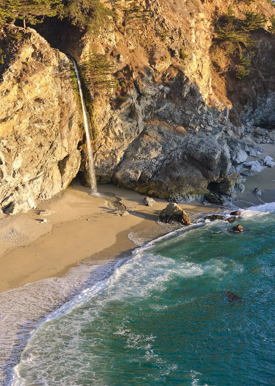
The whole day for 90 miles: Bixby Creek Bridge, Pfeiffer Beach’s keyhole arch, McWay Falls dropping onto the sand, a lunch with a view, then down to Ragged Point. See our Big Sur guide.
about 95 mi · 3 h+ with stopsSleep: Cambria
- 4
Day 4 · Elephant seals, Hearst Castle, Santa Barbara
The elephant seal rookery at Piedras Blancas (free, roadside), a booked tour of Hearst Castle, Morro Rock, then US-101 to Santa Barbara for an evening on State Street.
about 140 mi · 2 h 45Sleep: Santa Barbara
- 5
Day 5 · Malibu and Santa Monica
The Old Mission in the morning, then Highway 1 again along Malibu: El Matador State Beach, Point Dume, and the Santa Monica Pier at sunset. See our Los Angeles guide.
about 95 mi · 2 h 15Sleep: [Los Angeles](/cities/los-angeles/)
Short on days? Part of this route also works as a short trip, planned hour by hour:
Big Sur closures: check before you go
Landslides have closed stretches of Highway 1 south of Big Sur village for months at a time in recent years. When the road is cut, you can still drive from Carmel down to the closure and back, and reach Cambria and Hearst Castle from the south. To continue between the two, the detour runs inland on US-101 via Salinas and Paso Robles, then Highway 46 to Cambria — about two hours longer.
Best month to drive Highway 1
September and October are the clearest months on the central coast: the summer fog (“June gloom”) has burned off and the water is at its warmest. April and May bring green hills and wildflowers but occasional morning fog. Winter storms are the main cause of landslides, and some days bring heavy rain — beautiful when it clears, but closures are more likely.
What to book ahead
- A room in Big Sur (few lodges, booked months ahead) or Cambria.
- Hearst Castle tour tickets, sold through California State Parks’ reservation system.
- Monterey Bay Aquarium timed tickets for weekends and holidays.
- A one-way car rental San Francisco–Los Angeles: compare the drop-off fee across companies.
Shorter or longer
San Francisco to Big Sur and back
3 days
Monterey, Carmel and a day in Big Sur, returning inland on US-101. No one-way fee.
Continue to San Diego
7 days
Add Laguna Beach, La Jolla and San Diego: our full Pacific Coast Highway.
Pinnacles on the way
+1 day
An inland detour from Monterey to Pinnacles National Park’s volcanic spires and talus caves.
Where to sleep along the way
Book the nights that matter first — inside or next to the parks, and in towns hosting a festival — then fill in the rest. Free cancellation keeps the plan flexible.
Partner links · Trip.com
Our hand-picked hotels on this route
Road trip questions
How many days do you need to drive Highway 1 from San Francisco to LA?
Five days is ideal. It can be driven in one long day (about 10 hours without stops), but you would see Big Sur through a windshield.
Is Highway 1 through Big Sur open?
It depends on the season and on landslide repairs. Check Caltrans QuickMap before you set off; when it is closed, the inland detour via US-101 and Highway 46 adds about two hours.
Should you drive Highway 1 north to south or south to north?
North to south: you are in the lane next to the ocean, which makes pulling into viewpoints easier and the views better.
Where should you stay on Highway 1?
Monterey or Carmel, then Big Sur or Cambria, then Santa Barbara. Big Sur has very few rooms, so book it first.
Written by Kylian Dev. Distances and drive times are without stops or traffic; add 25% for a realistic day.